Table of Contents
Overview of Dwarahat
The Kumaon Mountains’ historic village of Dwarahat, which is home to magnificent temples and gorgeous scenery, makes for an excellent getaway. Dwarahat is a site with a unique heritage and religious significance. It is located in the magnificent Almora district in Uttarakhand. Dwarahat is the epitome of the region’s glorious history and its architectural brilliance. It is home to around 55 odd ancient temples that the Katyuri Kings erected throughout the mediaeval eras. As a result, it is often referred to as “The Town of Temples.”
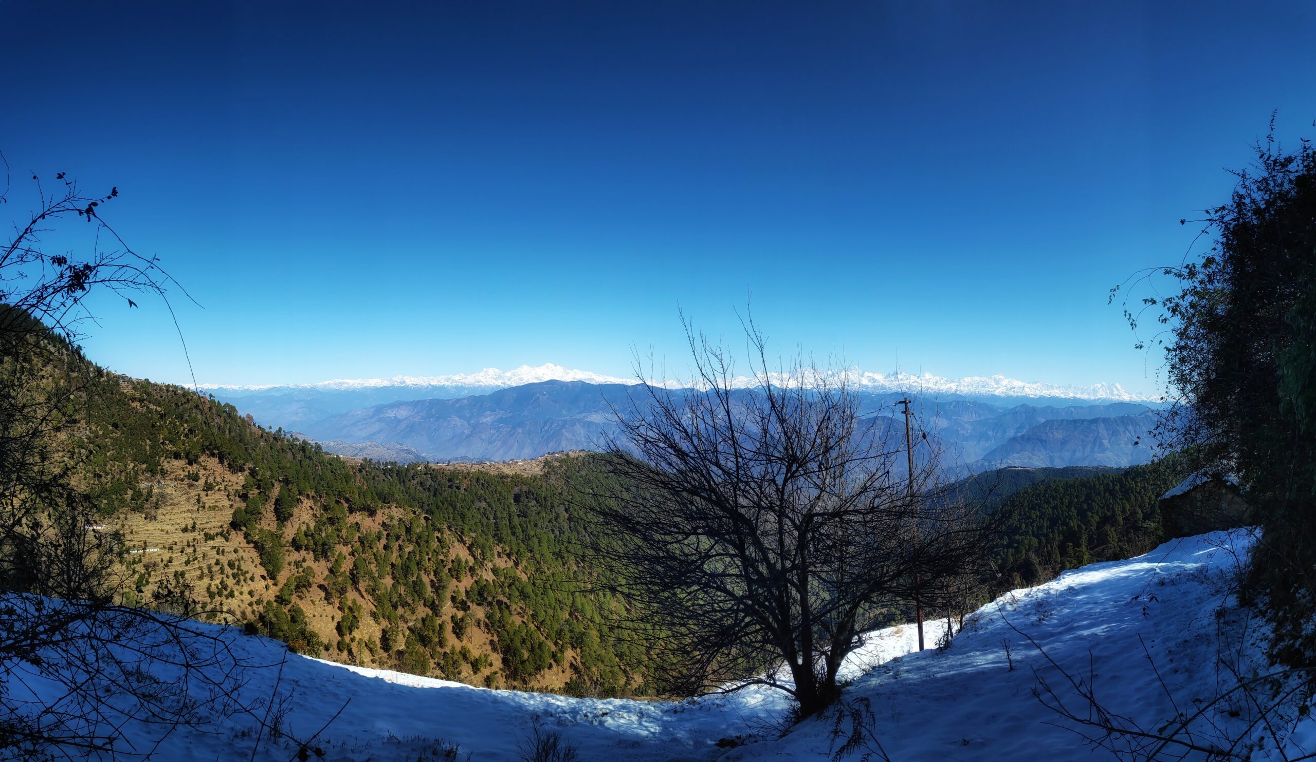
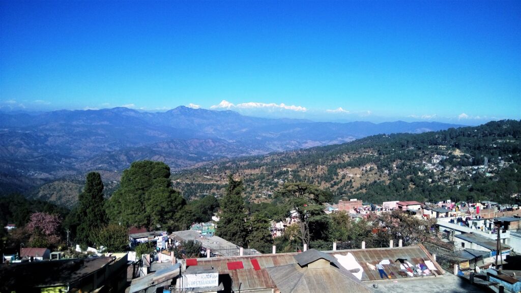
These temples are not only important historically, but they also contain some of the most adored deities in Hindu mythology, drawing visitors from all across the nation and outside. Dwarahat, perched at a height of 1,510 metres, offers picturesque views of the impressive Himalayan peaks, including Kailash Mansoravar, Dunagiri, and others. Away from the crowds of tourists at most other hill stations, Dwarahat is a spot where one may relax and recuperate.
Culture and Cuisine in Dwarahat
You may also sample some amazing Kumauni and Garhwali dishes, such aloo ke gutke, gahat, chainsoo, and kaapa. The festivals of Makar Sankranti, Basant Panchami, Herala and Bhaitauli, Olgia, Khatarua, Bat Savitri, and Ganga Dusshera are joyfully observed in Dwarahat, as they are in other parts of the Kumaon. At Dwarahat, a few fairs are also conducted. These include the Syalde Bikhauti Mela, which is held on Vishuwat Sankranti day, and the Doonagiri Mela, which is located 52 kilometres from Ranikhet.
History of Dwarahat
Kunindas tribe was the first to inhabit the area. From 500 B.C. until 600 A.D., the Kunindas ruled the region; their power fell with the emergence of the Guptas. Art, architecture, sculpture, paintings, and literature all experienced tremendous growth throughout the Gupta era. Additionally, the Chand and Katyuri emperors ruled the region. Their dominion encompassed the whole region of Rohelkhand and reached from the Satluj River in the west to the Gandak River in the east. Later, around the 16th century, the Chand Kings of Kumaon took control of the region.
Mythology
In Hindu legend, the confluence of the Ramganga and Saryu rivers was at Dwarahat, but the envious Kosi River started a dispute between the two rivers by claiming that the other wouldn’t be there for a meeting. As the truth came to light, the Saryu Rivers cursed the Kosi River, making sure that she would spend the rest of her days wandering alone while the other rivers would converge. Because of this, the Kosi River runs alone in the middle of nothing.
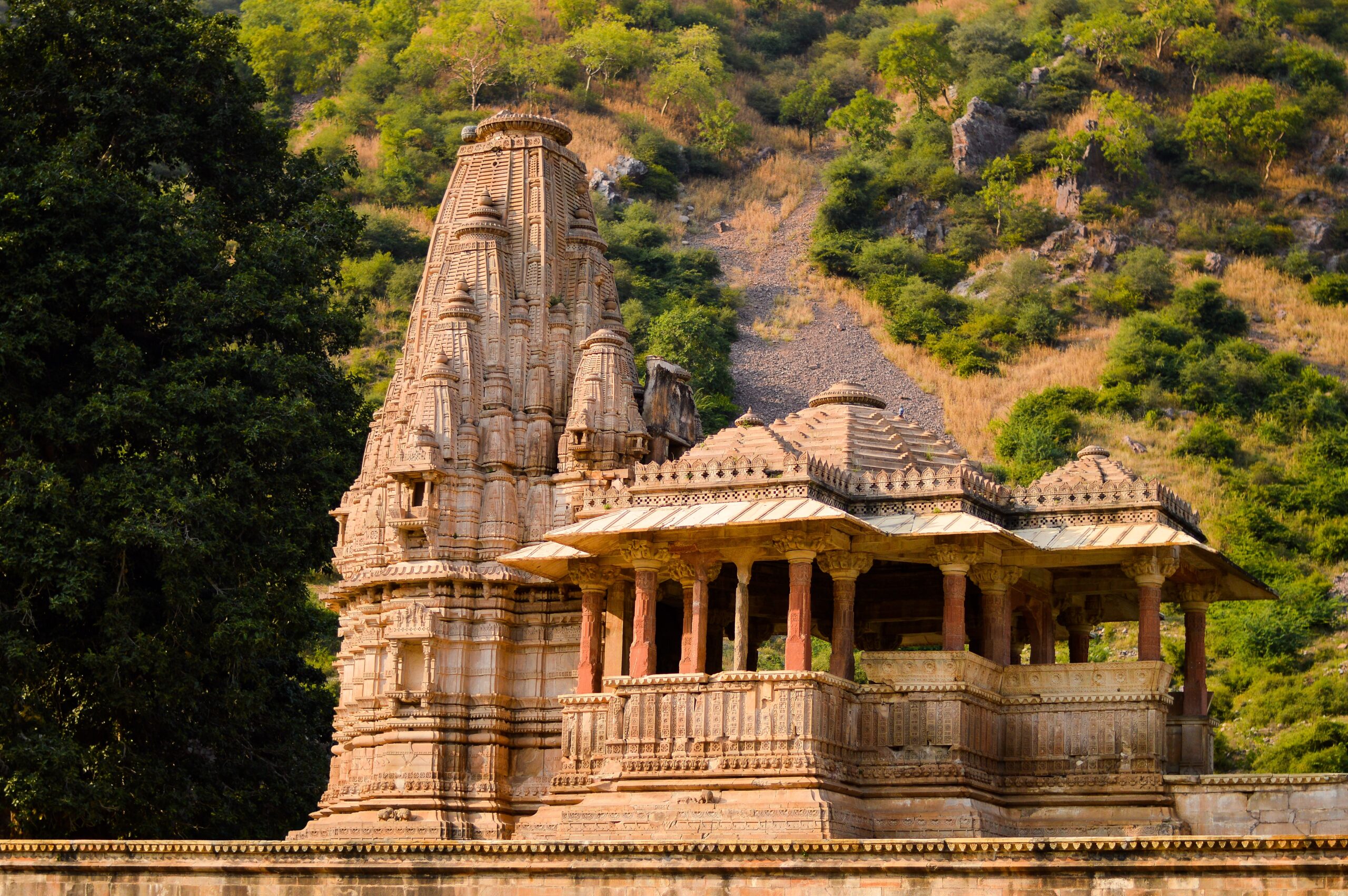
Architecture of Dwarahat Temples
These temples were built using Maru-Pratihara, Nagara, or Indo-Aryan architectural styles. Pre-Cambrian granite stones that are locally accessible are used as the principal building material for the temples’ construction. Iron clamps and dowels have been used to attach adjacent blocks in place of mortar. These temples today have a high archaeological importance as a result.
Group of Temples in Dwarahat
Dunagiri Temple: Dunagiri Temple stands out as one of the most notable of these temples that grace this location. Goddess Durga is honoured in this shrine. In the middle of the lush green Kumaon Hills, the temple is situated on a little hillside. Devotees must climb up a staircase of 500 steps to get to the temple because it is on a hilltop. The temple is most beautiful during Navaratri when it glitters with offerings from the faithful.
Badrinath Group of Temples: There are three temples there, the major one of which is devoted to Lord Vishnu, also known as Badrinath. It is built in the Sikhara architectural style, with the garbhagriha, antrala, and mandapa facing east. In the shrine is the black stone statue of Vishnu. The temple is inscribed with the number samvat 1105, which indicates that it was built about 1048 AD. Two other little shrines are included in the collection; one of them is devoted to Godess Laxmi, while the other is empty.
Bandeo Temple: It is situated on the banks of Khiru Ganga, a little creek, in the middle of farmed fields. This pyramidal shrine is the central Himalaya’s first fully built temple.
Gujar Deo Temple: It might be referred to as a masterpiece of Sekhari Sikhara-style temple building in the area. The temple has an orthogonal panchratha design. This temple is an example of the Central Himalayan region’s most advanced kind of Nagara temple. It is dated to the 13th century AD based on the architecture and sculptural art. The temple is currently in poor shape.
Kacheri Group of Temples: It features 12 shrines, five of which are located in two rows each, with the other two standing apart on a higher terrace. These temples date from the 11th to the 13th century AD. These shrines share a portico with a row of independent pillars that have simple brackets and shafts in front. These temples have Lord Siva and Lord Vishnu as their patron deities. The compound also has a circular well composed of stone blocks.
Maniyan Group of Temples: Nine temples make up this complex. Four shrines are constructed such that they function as a single unit with a shared courtyard in front of them. Three shrines have the Jain thirthankara depicted on their lintels, indicating that they are devoted to the Jain sect, which is uncommon in this area. However, it appears that the remaining temples are devoted to Brahminical deities. This collection of temples is dated to the 11th through the 13th centuries.
Mritunjaya Group: One of Dwarahat’s holiest clusters of temples is this one. Lord Shiva’s main temple, also known as Mritunjaya, dates to the 11th and 12th centuries AD. There is a garbhagriha, antarala, and mandapa in this nagara temple. In the same compound, there is a different temple devoted to Bhairav, while other temples are empty and in disrepair.
The Ratan Deo Temple: There are nine shrines in this complex, however as of right now, only six temples are still standing. A typical mandapa faces north and is followed by three temples, one each for the gods Brahma, Vishnu, and Siva. One of the subsidiary shrines is located to the west, while the other two are located to the east and are devoted to different Hindu deities. These temples are thought to date from the 11th to the 13th centuries.

Geography of Dwarahat
In the Indian state of Uttarakhand’s Almora district, there is a town and nagar panchayat with the name of Dwarahat. The coordinates of Dwarahat are (29°47′ 79°26′). Its elevation is typically 1,510 metres. Dwarahat provides tourists with expansive views of the surrounding area because of its location in the charming Ramganga Valley. The rarest plant is said to grow on the grounds of the Shakti Temple, Sanjivani.
Weather of Dwarahat
Summer (March to June)
The greatest time to travel to Dwarahat is during the sunny months of March to June, when the highest temperature barely reaches 21°C, making it even more pleasant to view the tourist sites.
Monsoon (July to September)
When the temperature dips to 12°C in July through September, Dwarahat experiences heavy rains. Due to bottlenecks and the persistent rain, a tour of the town appears impossible.
Winters (November to February)
Take pleasure in the frigid winters in the dwarahat. When the temperature drops to 7°C from December to February, the town truly transforms into a tropical haven.
Nearby Places to Visit
Dunagiri Temple (13.7 km), Pandukholi (24 km), Lakhanpur Temple (25 km), Yogoda Satsanga Sakha Ashram (1.5 km), Taragtal (5 km), Chaukhutiya (18 km), Someshwar (32 km), Mahavatar Babaji Cave (25 km)
Accommodation
Dwarahat doesn’t have much to offer in terms of lodging except than an ashram. You should look for lodging in Ranikhet, which is 37 km from Dwarahat and offers excellent lodging alternatives at affordable prices.
How To Reach
By Air: The closest airport to this serene tourist location is Pantnagar Airport, which is situated 148 km from Dwarahat. Once you arrive, hiring a taxi from the airport won’t be too difficult.
By Road: Dwarahat is best reached by car as it is situated along NH-87, a route that connects the Kumaon and Garhwal areas and makes it simple to travel between them. Not just in Uttarakhand, but also in numerous other significant towns in North India, tourists may rent buses and taxis at the top tourist spots.
By Rail: The closest railroad station to Dwarahat is Kathgodam Railway Station, which is located 114 km away. You may simply use a bus or taxi service from there.
Dwarhat Tour Cost
How much does Dwarahat tour cost?
Total Cost INR 5,100/–
Cost for 2 Nights Stay (per person)- Starting Point Delhi
Transport- INR 2,000/- including return
Hotel- INR 1,000/-
Food- INR 1,000/-
Other Things- INR 1,100/-
Thank You for Visiting Our Website “Fact Houses” (facthouses.com)